
Ñaupa Iglesia is one of the most mysterious Inca sites in the Sacred Valley of Peru. Located near Pachar and Ollantaytambo, this hidden ceremonial temple combines ancient stonework, spiritual symbolism, and stunning Andean landscapes.
👉 Visit this sacred place with our Sacred Valley Enigma Tour or explore more cultural sites with a Sacred Valley private tour.
Ñaupa Iglesia, also known as Naupa Iglesia, means “Old Church” in Quechua. Despite the name, this was not originally a Christian church. It is believed to have been a sacred Andean ceremonial site used for offerings, rituals, and spiritual connection with the surrounding mountains.
The site is especially known for its carved volcanic rock, trapezoidal niches, symbolic motifs, and the presence of a Chakana, the Andean cross that represents the Inca worldview.

Ñaupa Iglesia is deeply connected to the spiritual and cultural history of the Sacred Valley. Unlike more famous sites such as Machu Picchu or Ollantaytambo, this place remains quiet, mysterious, and less visited.
Its location suggests that it may have been part of a sacred network linked to Pisac, Ollantaytambo, and Machu Picchu. Ancient Andean people likely used the site for ceremonies connected to the mountains, agriculture, water, and the cosmos.
The site stands out for its unique construction and sacred design. Its main temple is carved into a natural volcanic rock formation and includes details that reflect advanced Andean craftsmanship.
These features make Ñaupa Iglesia one of the most fascinating hidden sites near Ollantaytambo.
In the Andean worldview, mountains, rivers, caves, and rocks were considered living sacred beings. Ñaupa Iglesia may have functioned as a waka, or sacred shrine, where offerings were made to honor the valley and the Apus, the protective mountain spirits.
This spiritual significance makes the site so powerful for travelers interested in Andean culture, ancient beliefs, and sacred geography.
Local stories describe Ñaupa Iglesia as a place of mystery, energy, and hidden knowledge. Some legends speak of ancient rituals, secret chambers, and connections with old Inca roads.
While many of these stories remain part of the oral tradition, they enhance the site’s atmosphere and make the visit even more memorable.
Ñaupa Iglesia is located near the community of Pachar, within the archaeological area of Ollantaytambo, in the Urubamba province of Cusco. The site sits at approximately 2,800 to 2,900 meters above sea level.
It is located close to the railway line that connects Cusco and Machu Picchu, making it a strategic stop in the Sacred Valley.

From Cusco, the most common route is through Chinchero, Urubamba, Ollantaytambo, and Pachar. From Pachar, visitors walk approximately 2.2 km to reach the archaeological site.
👉 The easiest way to visit is with our Sacred Valley Enigma Tour, designed for travelers interested in hidden Inca sites and spiritual places.
Visiting Ñaupa Iglesia is different from visiting crowded tourist attractions. The site is quiet, mystical, and surrounded by beautiful Andean scenery.
Because the site involves walking at altitude, travelers should take their time and stay hydrated. You can also read our altitude sickness guide before visiting the Andes.
Ñaupa Iglesia can be combined with other important sites in the Sacred Valley:
👉 For a complete cultural experience, consider our Sacred Valley private tour or the Sacred Valley Pisac tour.
Because Ñaupa Iglesia is located near the route to Ollantaytambo, it can be a great cultural stop before continuing toward Machu Picchu.
👉 If you want to extend your journey, explore our Machu Picchu full-day tour or combine the Sacred Valley with Machu Picchu on a Sacred Valley and Machu Picchu 2-day tour.
Ñaupa Iglesia is perfect for travelers who want to go beyond the classic tourist route. It offers mystery, history, spirituality, and a deeper connection with Andean culture.
If you enjoy hidden archaeological sites, sacred landscapes, and less crowded places, Ñaupa Iglesia deserves a place in your Sacred Valley itinerary.
Ñaupa Iglesia is one of the Sacred Valley’s most intriguing hidden gems. Its carved rock temple, spiritual symbolism, and dramatic location make it a meaningful stop for travelers interested in Peru’s ancient past.
👉 Discover this mysterious Inca site with Kondor Path Tours through our Sacred Valley Enigma Tour.

Complete guide to visiting the last Inca rope bridge in Peru from Cusco. Planning to visit the Q’eswachaka…

Planning to attend Inti Raymi 2026 in Cusco? This complete travel guide covers everything you need to know…
Last-Minute Machu Picchu: How Travelers Still Visit Without Tickets from Cusco The Reality of Last-Minute Travel in Cusco…

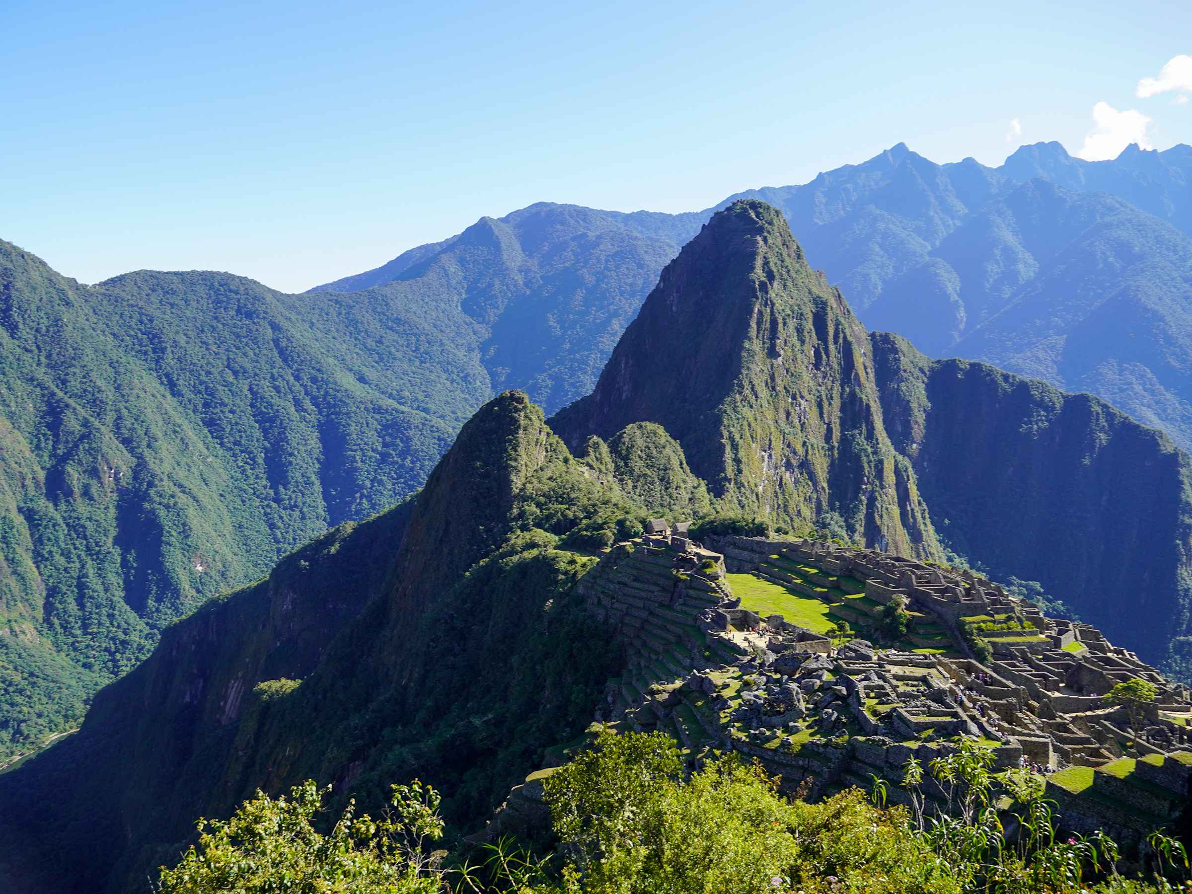
Machu Picchu and Hiram Bingham’s Legacy: Rediscovery, Debate, and Historical Impact Machu Picchu continues to fascinate travelers, historians,…
Machu Picchu is not only one of the most iconic archaeological sites in the world — it is…

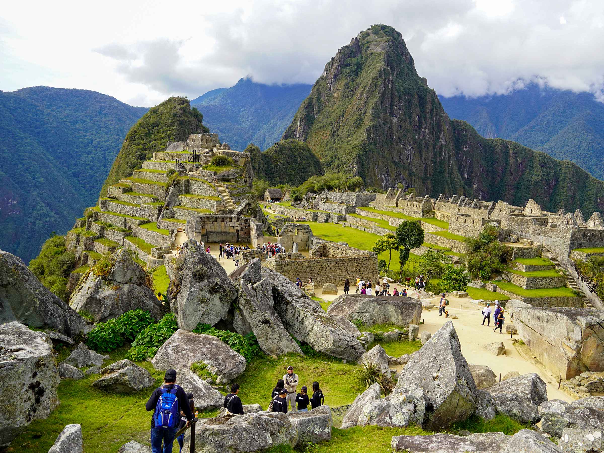
The terraces of Machu Picchu are one of the most impressive features of the site. Built into the…

Machu Picchu is one of the greatest examples of ancient engineering in the world. One of its most…

Machu Picchu is not only an archaeological wonder—it is also a deeply spiritual place. Surrounded by sacred mountains…
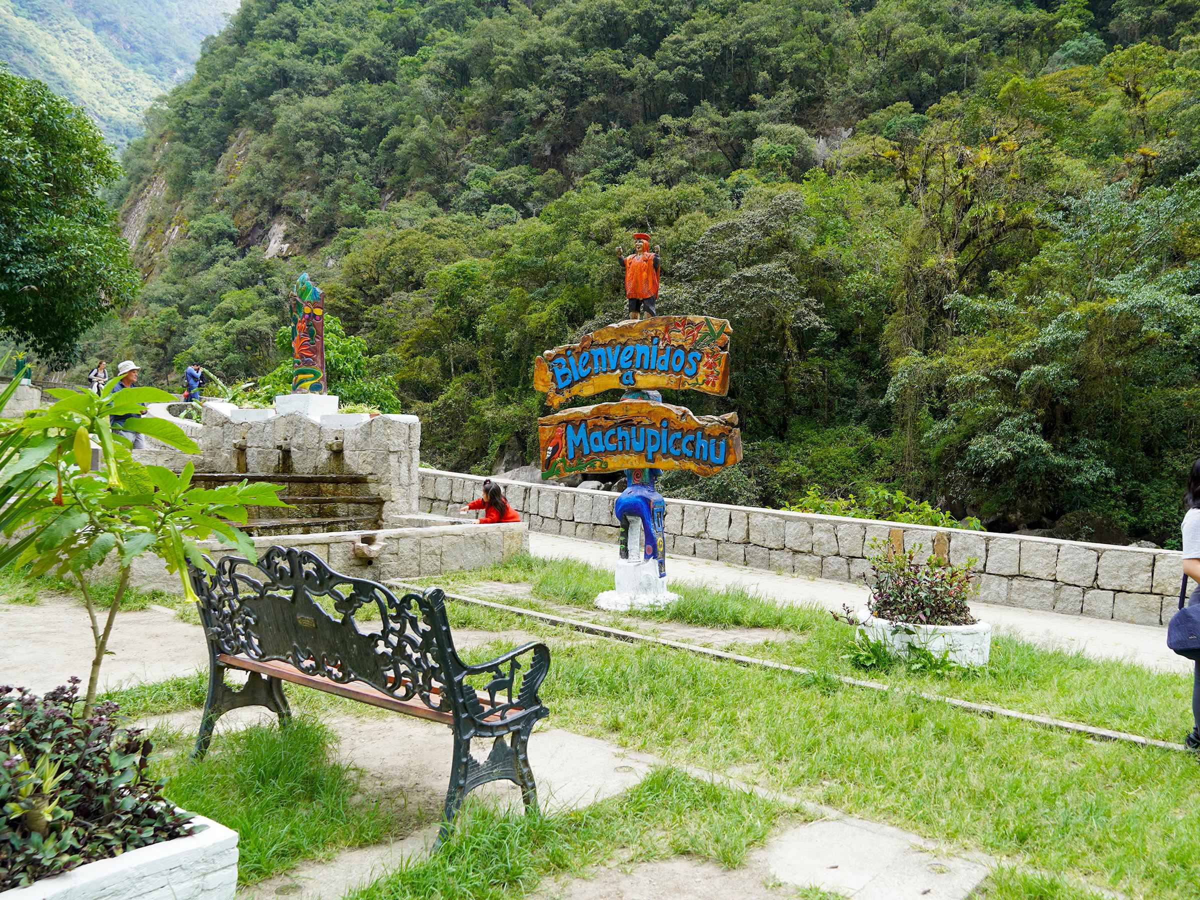
Aguas Calientes: The Gateway to Machu Picchu Aguas Calientes, also known as Machu Picchu Pueblo, is the main…

Peru Altitude Guide Peru is a land of breathtaking landscapes and rich cultural heritage. Its diverse geography includes…

Planning a Machu Picchu climb? There is more than one way to reach the citadel — from multi-day…

The Sacred Valley of Cusco is not just a stop on the way to Machu Picchu—it’s one of…