
The Colca Valley is one of Peru’s most spectacular travel destinations, combining dramatic canyon landscapes, traditional Andean villages, wildlife, and cultural heritage.
Located in the Arequipa region, the Colca Canyon attracts travelers from around the world seeking breathtaking scenery, condor-watching, trekking, and authentic cultural experiences.
👉 Explore unforgettable
Colca Canyon tours
and southern Peru adventures.

The Colca Valley offers a unique combination of:
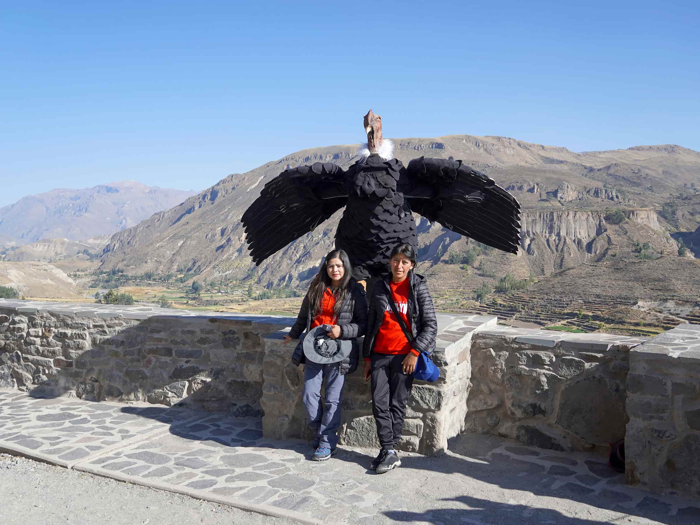
The region is also home to one of the best places in South America to observe the majestic Andean condor.
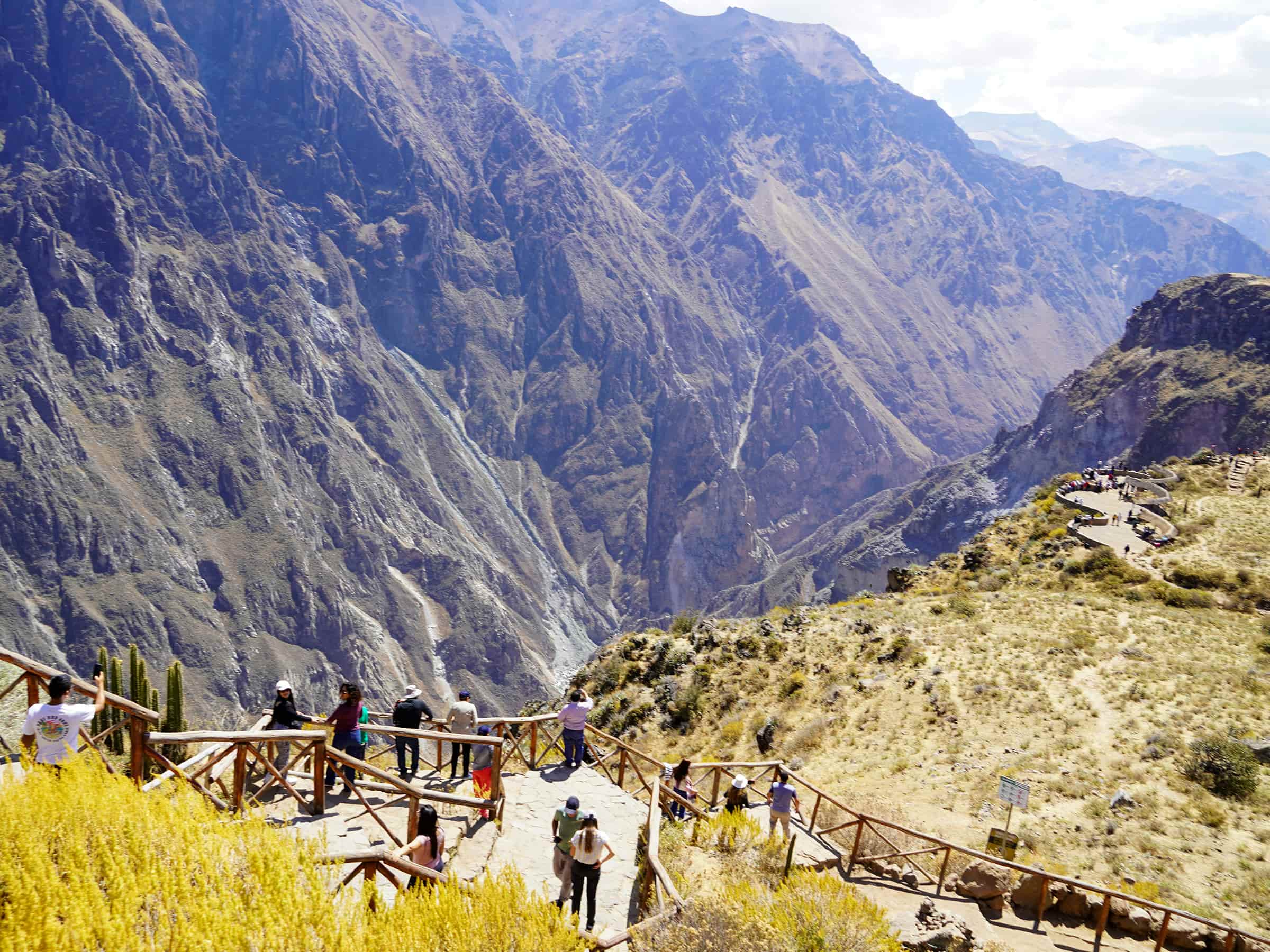
Mirador Cruz del Condor is the most famous viewpoint in the Colca Valley.
The viewpoint overlooks the dramatic depths of the Colca Canyon and offers incredible opportunities to observe Andean condors soaring above the canyon walls.
Early morning visits provide the best conditions for condor viewing.
👉 Discover unforgettable
Colca Canyon experiences.

Chivay is the main gateway town to the Colca Valley and an important stop for travelers exploring the canyon region.
The town offers:
Chivay also serves as an excellent base for acclimatization before trekking activities.
Located near Chivay, La Calera is one of the most popular thermal bath complexes in southern Peru.
The natural hot springs offer a relaxing experience amid mountain scenery.
Many travelers visit the hot springs after hiking or exploring the canyon.

Yanque is one of the most charming villages in the Colca Valley.
The village is known for:
Visitors can experience authentic local traditions while enjoying panoramic views of the valley.
Cabanaconde is one of the most important trekking gateways in the Colca Canyon region.
The village offers access to:
Its traditional atmosphere and mountain scenery make it one of the most memorable places in the valley.

The Colca Valley is famous for its impressive pre-Inca agricultural terraces.
These terraces continue to be used today and demonstrate the advanced farming techniques developed by ancient Andean civilizations.
The terraces create one of the most iconic landscapes in southern Peru.
Patapampa is one of the highest viewpoints on the road to Colca Canyon.
Located at approximately 4,800 meters (15,748 feet), the viewpoint offers panoramic views of:
The viewpoint is often called the “Mirador de los Andes.”

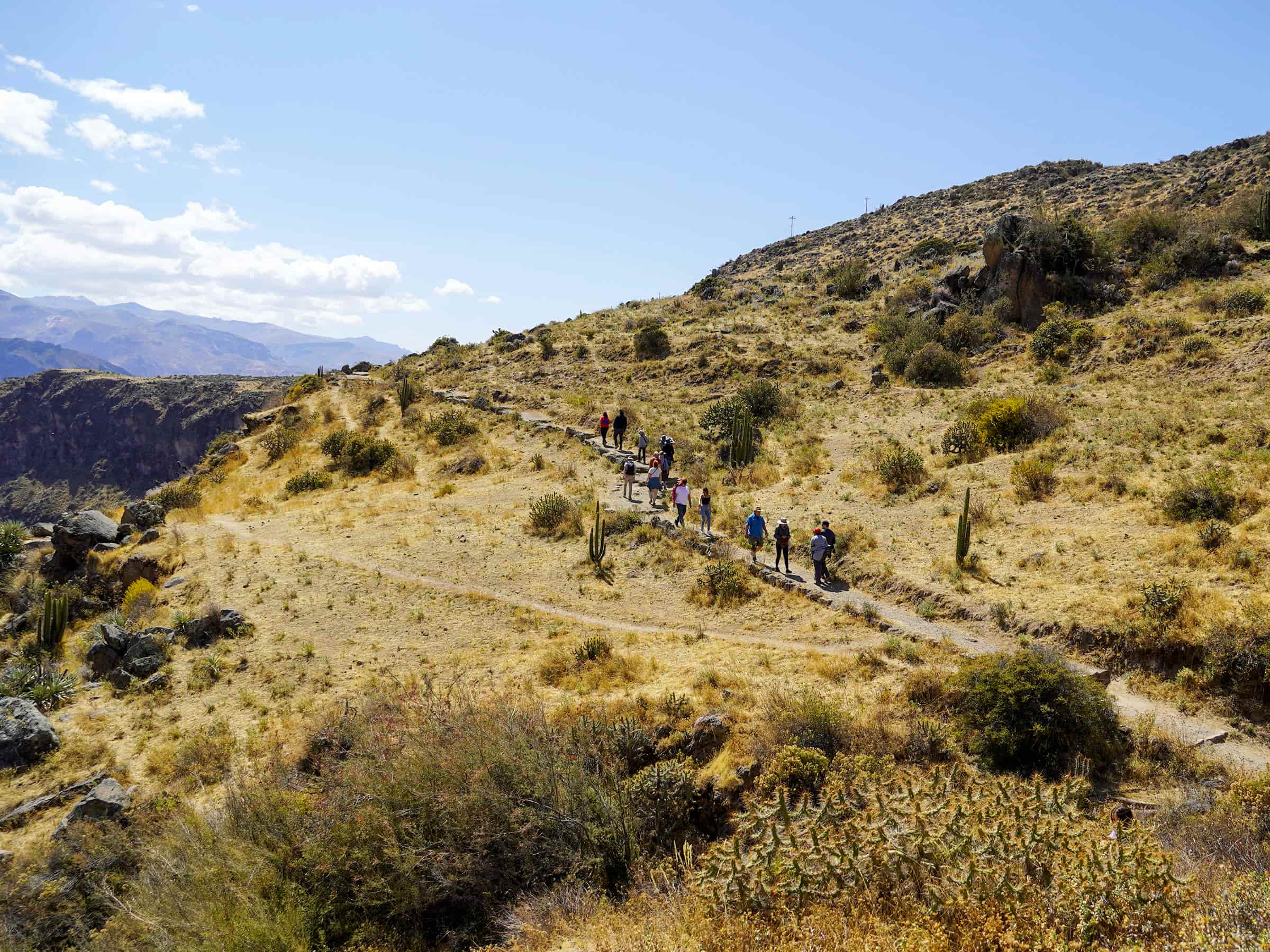
Colca Canyon offers some of Peru’s best trekking routes.
Popular hiking experiences include:
The trails combine dramatic landscapes, canyon views, and cultural encounters with local communities.
The Colca region supports diverse Andean wildlife.
Travelers may encounter:
The valley is one of Peru’s best destinations for wildlife photography.

The Sumbay Caves are home to ancient rock paintings dating back thousands of years.
The cave art depicts:
The site provides fascinating insight into the region’s prehistoric past.
Many villages throughout the valley preserve traditional Andean architecture and customs.
Popular villages include:
These communities offer travelers authentic cultural experiences and slower-paced tourism.

The dry season from April to November offers the best conditions for exploring the Colca Valley.
Travelers can expect:
👉 Read our best time to travel to Peru guide.
Many areas of the Colca Valley sit at high altitude.
Travelers should acclimatize properly before engaging in strenuous activities.
Common altitude symptoms include:
👉 Prepare properly with our altitude sickness guide.
Good preparation helps travelers enjoy a safer and more comfortable experience.
The Colca Valley is one of Peru’s most breathtaking destinations, combining dramatic canyon scenery, traditional Andean culture, wildlife, and unforgettable trekking experiences.
From soaring condors and ancient terraces to charming villages and mountain viewpoints, the region offers travelers a rich and diverse adventure in southern Peru.
Whether you are interested in nature, photography, hiking, or cultural exploration, the Colca Valley delivers one of the most memorable travel experiences in the Andes.
👉 Explore southern Peru with our
Colca Canyon travel experiences.

Planning a Colca Canyon trekking adventure in Peru is one of the best ways to experience dramatic Andean…

The Colca Canyon is a stunning natural wonder in the heart of the Peruvian Andes. It attracts adventurers…
Colca Canyon is one of Peru’s most breathtaking natural destinations. Located in the Andes near Arequipa, this spectacular…
Colca Canyon is one of Peru’s most extraordinary natural destinations and one of the world’s deepest canyons. Located…

Embarking on a journey from Arequipa to the Colca Canyon is an adventure that promises breathtaking landscapes, rich…
Journey into the Depths of Colca Canyon: Nestled in the Andes of southern Peru, Colca Canyon is one…

Experiencing the Colca Canyon tour in Peru is much more than admiring dramatic landscapes and deep canyons. It…
Exploring the Colca Canyon Trek in Peru is one of the most rewarding adventures for travelers who love…

Colca Canyon is not only one of the deepest canyons in the world — it’s also a destination…