
High in the Peruvian Andes, Waqrapukara is one of Cusco’s most fascinating hidden archaeological sites. Known as the “Horned Fortress” in Quechua, this remote Inca sanctuary combines breathtaking landscapes, ancient architecture, and spiritual significance.
Unlike crowded destinations, Waqrapukara offers travelers a quieter and more adventurous experience in the Andes.
👉 Explore this incredible site with our
Waqrapukara Trek
and discover one of Peru’s hidden treasures.

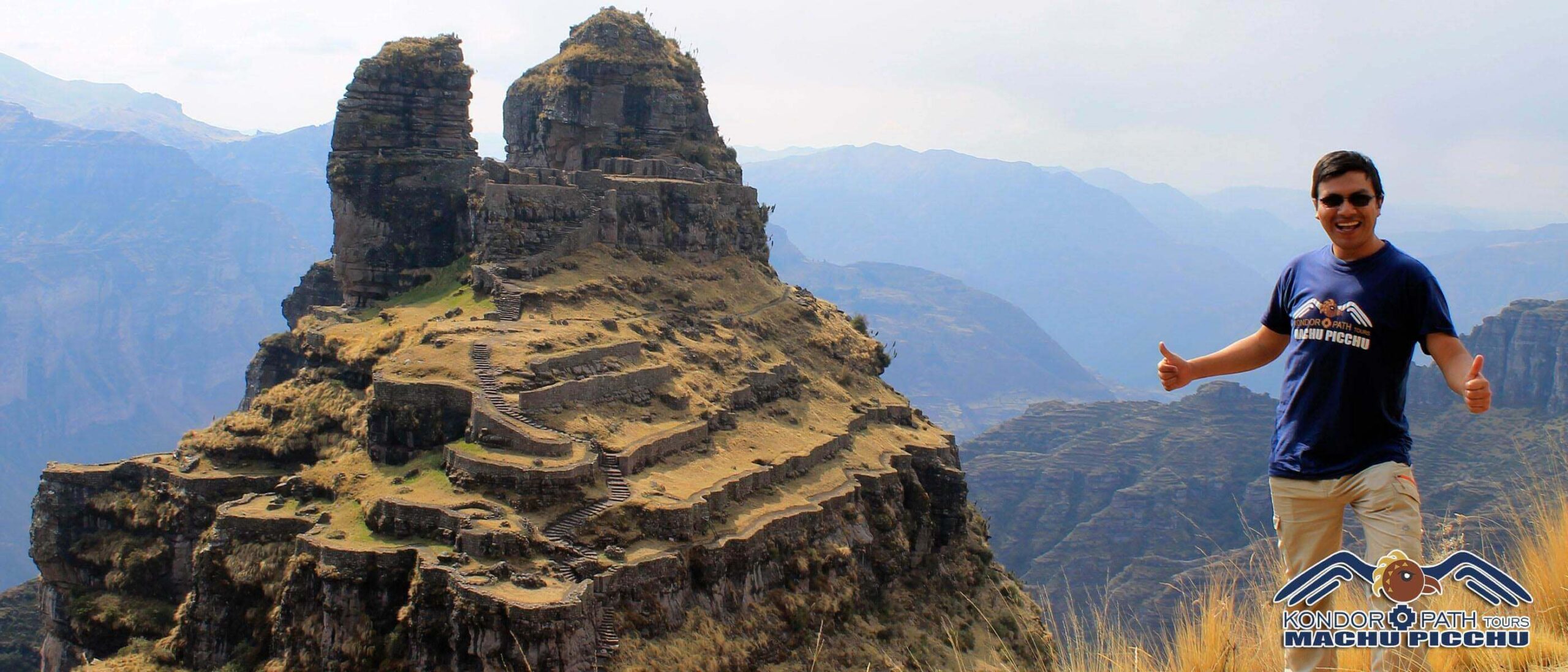
Waqrapukara is an ancient Inca archaeological site located approximately 110 kilometers southwest of Cusco, at an altitude of around 4,300 meters (14,100 feet).
The name combines the Quechua words:
The site is famous for its dramatic horn-shaped rock formations overlooking the Apurímac Canyon.
Unlike Machu Picchu, Waqrapukara remains relatively unknown, making it ideal for travelers seeking authentic experiences away from large tourist crowds.
Reaching Waqrapukara is part of the adventure. The route includes scenic drives through remote Andean villages and a rewarding hike through mountains, valleys, and grasslands.
The trek offers incredible opportunities to experience the natural beauty of the Cusco region.
👉 Experience the full adventure with our
guided Waqrapukara hike.
The Waqrapukara trail crosses stunning Andean landscapes filled with native flora and fauna.
The peaceful environment makes Waqrapukara one of the best off-the-beaten-path experiences near Cusco.
Archaeologists believe Waqrapukara served as both a ceremonial sanctuary and defensive fortress during the late Inca period.
The site includes:
The Incas carefully integrated the structures into the natural landscape, reflecting their deep spiritual connection with the Andes.
The stonework of Waqrapukara demonstrates the remarkable engineering abilities of the Incas.
The architecture blends naturally with the surrounding cliffs and rock formations.
While Machu Picchu is world-famous, Waqrapukara offers a very different experience.
👉 Travelers looking for hidden archaeological sites often combine Waqrapukara with experiences such as the
Salkantay Trek
or the
Classic Inca Trail.
The most common route starts from Cusco and passes through Sangarará and Acomayo before reaching the trailhead.
👉 Guided experiences are recommended due to altitude and remote terrain.
The dry season (May to September) offers the best hiking conditions, clearer skies, and safer trails.
During the rainy season, trails may become muddy and more difficult.
👉 Prepare for altitude with our altitude sickness guide.
Waqrapukara is perfect for travelers seeking authentic adventure, history, and spectacular mountain scenery.
Its remote atmosphere and spiritual energy make it one of Cusco’s most unforgettable hidden destinations.
Waqrapukara combines archaeology, trekking, culture, and breathtaking landscapes into one incredible experience.
👉 Discover this hidden Inca wonder with our
Waqrapukara Trek tour
and explore a different side of Cusco.